

Severe Weather Outbreak Possible Tomorrow (5/15)
Here's what to know as the system moves in tomorrow afternoon/evening

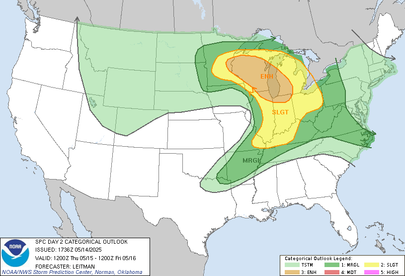
We’re in for another potential round of intense severe weather tomorrow! Although the convective outlook is less extreme than it was for the late-April event, the enhanced risk area is centered directly over Wisconsin. The main threats tomorrow are large hail and damaging winds, but tornadoes are possible too.
Hail
Hail is tied with damaging winds for the highest odds, with a 30% chance of any given area around Madison receiving hail. Madison is again under the hatched area, meaning there is a “10% or greater probability of two-inch diameter hail or larger within 25 miles of a point”.
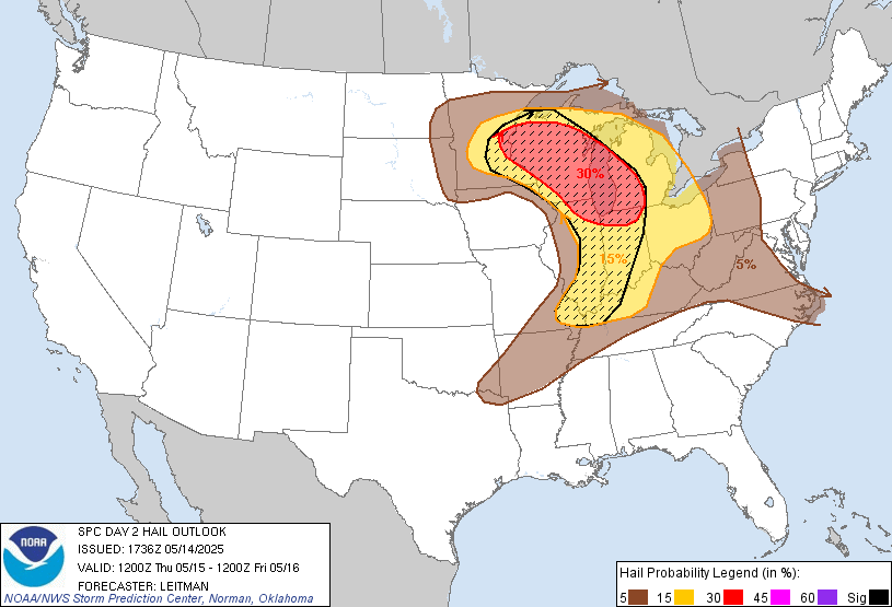
To reiterate, two-inch hail is roughly the size of a golf ball or a tennis ball, so significant damage to roofs, vehicles, and other structures is possible.
Expect strong winds
Madison faces a 30% chance of damaging thunderstorm winds or gusts of 50 knots (about 57 mph) or higher. There is no hatched area, though, so it's not extremely concerning.
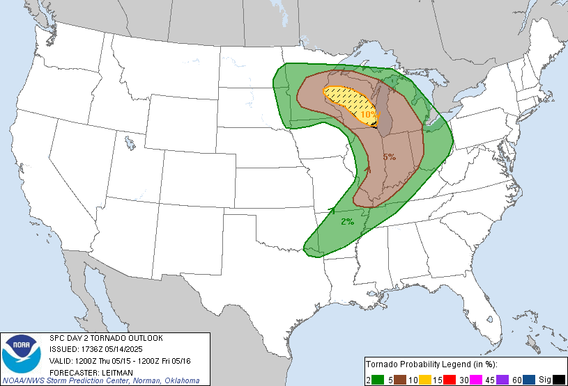
We can’t rule out tornadoes
Madison is right on the border of the 5-10% outlook for tornadoes, and is near (but not in) the hatched area, meaning there is not just a 10% chance of tornadoes, but a 10% or greater chance of EF2-EF5 tornadoes. Again though, Madison is not under that risk area, just near it.
Last time was a fluke, though… right?
Yes and no… there were several tornado-warned cells, including a touchdown near Eau Claire, but the lines of storms simply missed our area, and they indeed were not as bad as anticipated. I’d say we can rule out anything worse than that cycle, but we shall see whether it gets that bad.
Again, we’ll have an updated NWS model tomorrow morning on our Severe Weather Dashboard (linked below) as soon as possible. I’ll know later in the day if we’ll need to go live, so stay tuned.
