

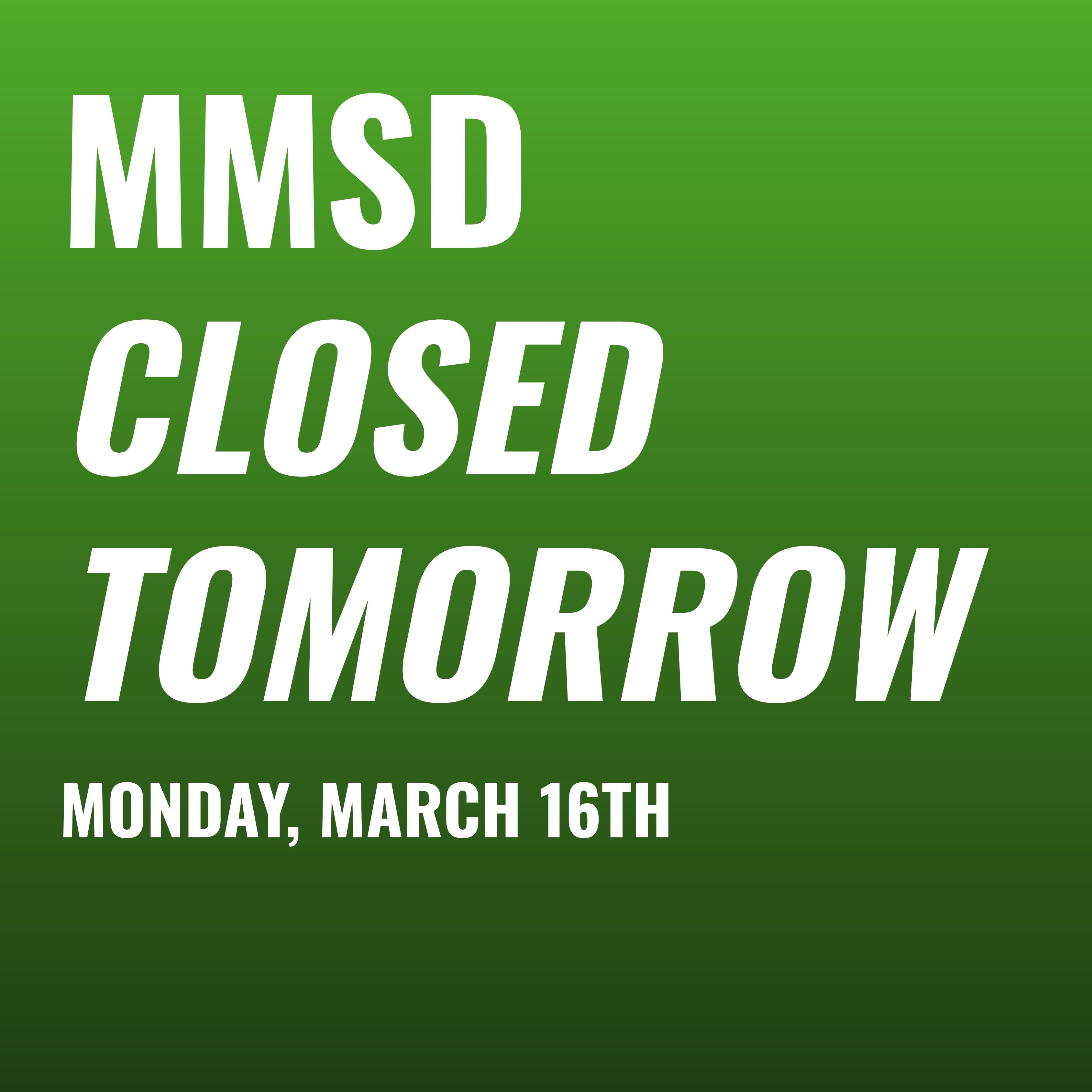
MMSD CLOSED MONDAY - Monday, March 16th
Madison may see over a foot of snow, blizzard-like conditions, and dangerous ice accumulations this weekend.

CLICK TO VIEW THE LATEST FORECAST
4:10 PM, Sunday, March 15th
With snow starting to really come down here, and all major districts in the area closing for tomorrow, I’m signing off for this storm. Please stay safe (and stay home if possible) as road conditions will likely be pretty bad tonight into tomorrow.
Live updates have concluded for this Alert Day.
11:49 AM, Sunday, March 15th
For those wondering why we posted here before you got an email/text from the district, AND before the news agencies had the call, that wasn’t magic. Apparently MMSD was having technical difficulties with their messaging systems, which is why the decision was posted on Instagram and Facebook before the official channels.
I am honestly shocked we called it before Sun Prairie, Verona, Middleton, and literally anyone else. I had been telling people originally I thought we’d get the announcement by noon today, but was starting to change my mind this morning. Turns out it worked anyways.
11:26 AM, Sunday, March 15th
We did it. MMSD has closed for Monday, March 16th. Our forecast concluded with a 95% chance of closure just before it was announced, due to much worse ice accumulation and wind forecasts.
9:20 AM, Sunday, March 15th
A few updates:
We have our very first closure for tomorrow, coming out of Portage, where they are switching to virtual learning. This barely affects the model, which places weight mainly on the “big three” (Middleton, Sun Prairie, Verona), but it’s a start.
The City of Madison just published their plowing update for this storm, including the following:
Travel in Madison will be difficult tonight (3/15) and tomorrow (3/16) due to the storm.
All paved surfaces will be slippery while this heavy, wet snow melts as fresh snow continues to fall and stack up.
The high winds could impact visibility, particularly on roads along open areas like farm fields.
Nothing we don’t know yet, but if city streets management are basically saying all roads will be slippery, that helps the case to close city schools in theory.
8:38 AM, Sunday, March 15th
Taking a look at where things stand this morning, you’ll find that the odds have dropped a little bit to just above a 70% chance of a closure, for a few reasons: the NWS hourly forecast has less snow, lower wind/gust speeds, slightly higher temps, and less ice in the mix now. However, road conditions are a bit worse on the beltline and the expected rate of snowfall went up a tiny bit, so those countered the decrease to some extent. No closures in the area to report yet, I’m guessing some will come in around noon.
11:09 PM, Saturday, March 14th
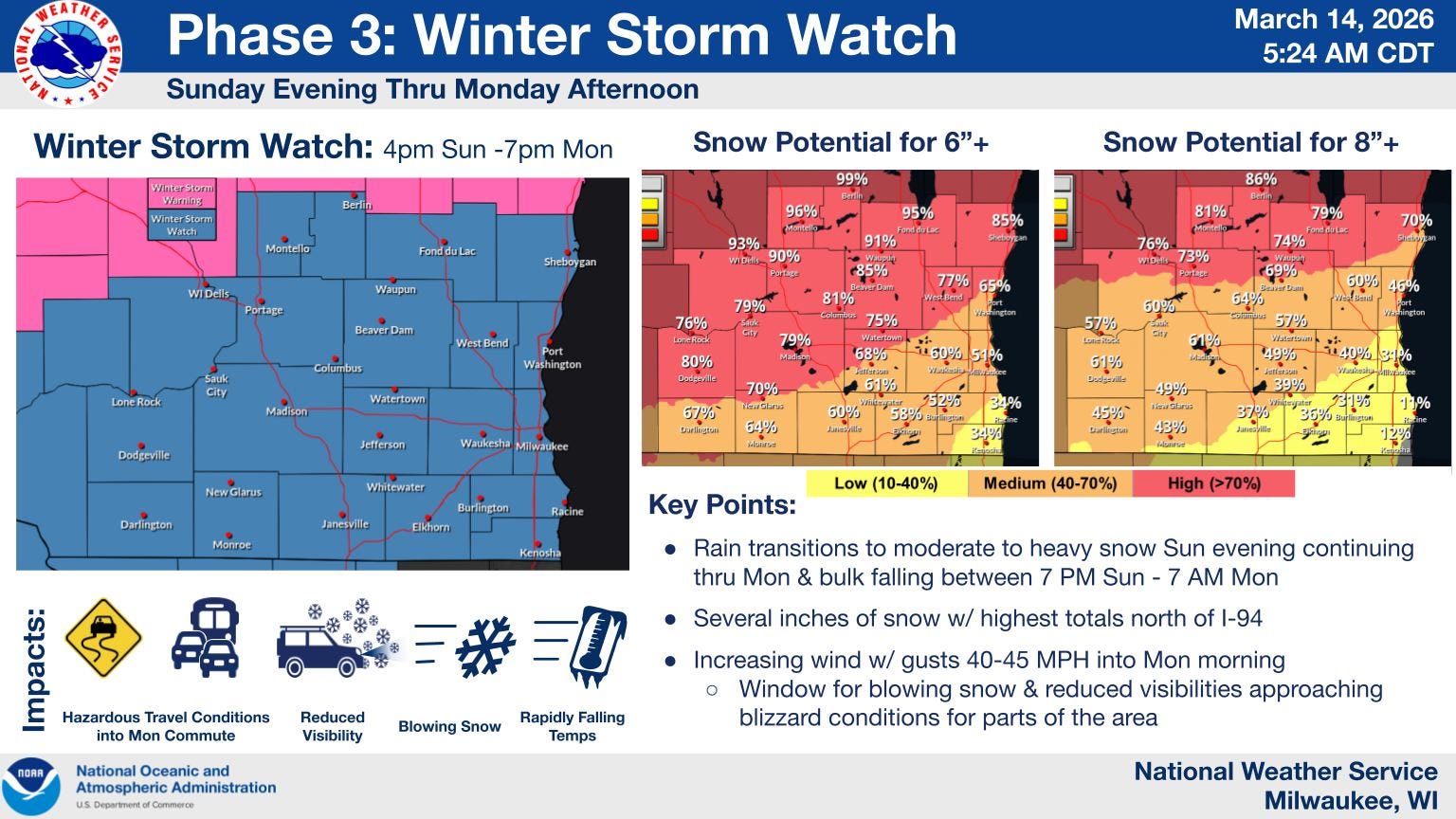
Well… that was hilarious timing. Immediately after I published the update below, the National Weather Service upgraded our Winter Storm Watch to a Winter Storm Warning from 7 PM tomorrow through 4 PM Monday. The warning is for snow from 4-7 inches as well as wind gusts up to 50 mph, “near blizzard” conditions. One thing that’s key from the end of the warning? "Persons should consider delaying all travel. Motorists should use extreme caution if travel is absolutely necessary.” Hey MMSD, this is for you 👀.
10:59 PM, Saturday, March 14th
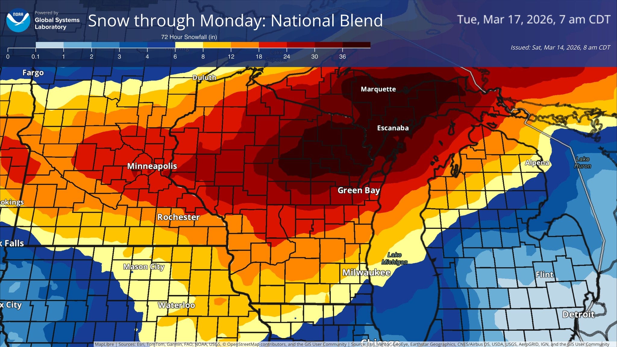
Final update for tonight: we remain at a 76.9% chance of a Monday closure, with a 7.3-inch point estimate for snowfall and a 5-10 inch range from the NWS and a 10-inch estimate from the GFS model, along with gusts up to 45 mph Monday morning, and minor ice accumulations that still could pose a hazard. There is a 63% probability of over 6 inches of snow, and a 44% probability of over 8 inches, per the latest NWS briefing. Tomorrow morning will be interesting as we see who closes and who doesn’t in our area, and we will see if the morning forecast updates change the odds significantly. I have a feeling a Blizzard Warning is still possible, so we shall see if that gets declared tomorrow too.
9:51 AM, Saturday, March 14th
Where things stand now: various models have begun to converge slightly, with the GFS dropping significantly and forecasting around 10 inches of snowfall through Monday morning, the NWS National Blend mode forecasting between 12 to 18 inches total, and the NWS latest hourly forecast having us at 7.1 inches total. We have narrowed (doesn’t feel like much) our range to about 5-20 inches, so we can at least eliminate the possibilities of either two feet of snow or a light dusting at this point. The NWS briefing from early this morning is a little odd, having us at a 79% chance of 4+ inches and a 61% chance of 6+ inches, but capping our range at 3-8 inches.
As far as timing, Madison seems like it will not get any snow now tonight, a change. The hourly forecast has things kicking off tomorrow night around 7 PM, continuing through Monday afternoon. However, what’s key is that the heaviest snowfall will be early morning Monday, with 0.6-0.7 (I know, I know) inches per hour. That will mean it’s extra challenging for city plows to clear streets as snow piles on at a fast pace early in the morning. What’s possibly more important is that the literal peak of projected wind/gust speeds is right at 7 AM, when elementary school transportation is underway. In other words, I still think conditions are coming together nicely for a closure, and will update you here as things develop.
2:29 PM, Friday, March 13th
Due to the huge snowfall amounts, possible blizzard conditions (strong gusts and snow), significant ice accumulations (over 0.1 inches), and more (oh my!) expected late Saturday through Monday, HDR Analytics is officially declaring Monday, March 16th, a MAJOR ALERT DAY. Check out the forecast above for the latest MMSD closure odds. We will post occasional updates here/on the Instagram.
My personal take on this one: If anything close to the current forecast holds and remains the same heading into Sunday morning, this is a no brainer closure for MMSD. This system is setting up to be dangerous, disruptive, and possibly the most impactful individual snowstorm in recent memory, but the forecasted path of the storm matters a lot, so we will keep an eye on that.