

🟥 LIVE UPDATES - 4/14 Severe Weather Outbreak
The Dane County area may see a huge storm system with dangerous tornadoes, giant hail, and damaging straight-line winds Tuesday afternoon and evening

SEVERE WEATHER DASHBOARD —> https://hdranalytics.com/severe-weather/
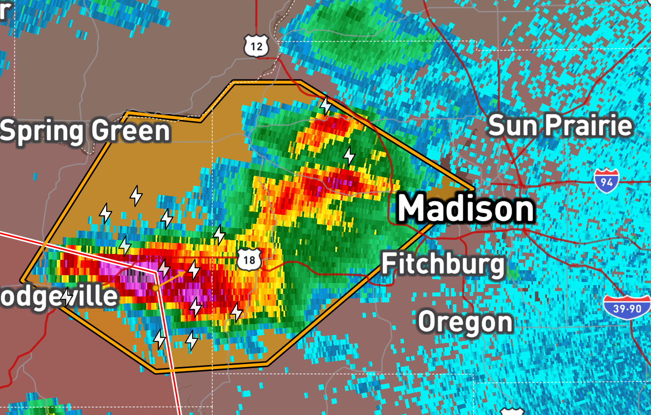
Tuesday, April 14th - 4:34 PM
Middleton and Northwest Madison are about to get absolutely pummeled by up to 2.5 inch hail… yikes.
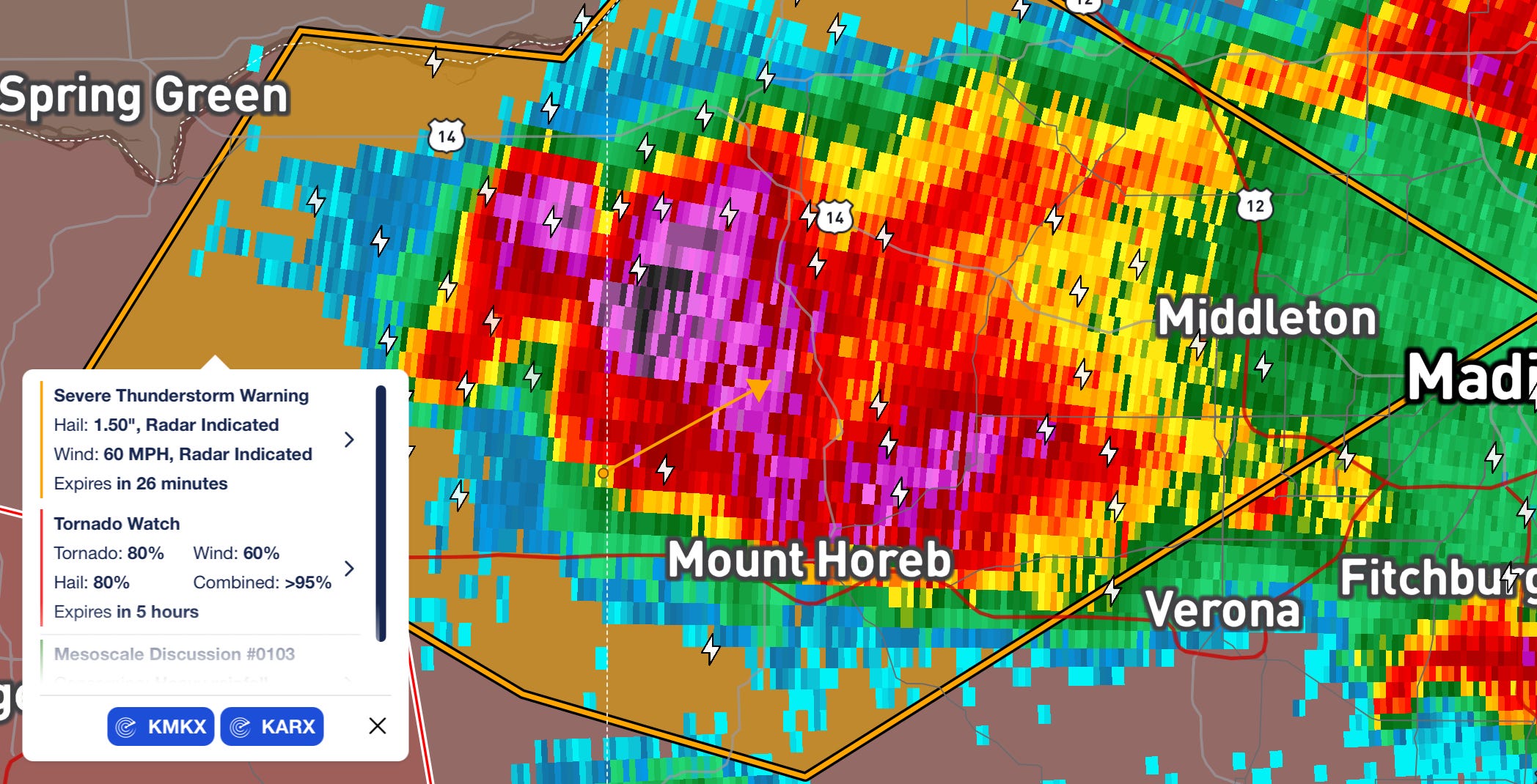
Tuesday, April 14th - 4:14 PM
We are under a Severe Thunderstorm Warning for the next hour for an approaching cell with significant hail and up to 60 MPH winds.
Tuesday, April 14th - 2:37 PM
Just got that Tornado Watch we were expecting! It extends until 10 PM Central for:
Several tornadoes and a couple intense tornadoes likely
Widespread large hail and scattered very large hail events to 4 inches in diameter likely
Scattered damaging winds likely with isolated significant gusts to 75 mph possible
Tuesday, April 14th - 1:05 PM
The latest mesoscale discussion from the National Weather Service gives a 95% chance of a Tornado Watch being issued in the next couple hours. Initial thunderstorm development is expected across parts of central/eastern Iowa near the by around 4 PM. The unstable atmosphere will favor rapid thunderstorm organization/intensification into supercells and organized clusters. Initially, very large to giant hail (2-3+ inches in diameter) and severe wind gusts will be the main concern. However, later this afternoon, conditions will favor a transition to a quickly increasing tornado risk, with strong to intense tornadoes with any longer-lived supercells, along with a continued risk of giant hail and severe gusts. The projections the Storm Prediction center is publishing are insane:
MOST PROBABLE PEAK TORNADO INTENSITY...120-150 MPH MOST PROBABLE PEAK WIND GUST...65-80 MPH MOST PROBABLE PEAK HAIL SIZE...2.75-4.25 IN
Tuesday, April 14th - 1:00 PM
Welcome to our Alert Day coverage for Tuesday, April 14th. We are tracking what could be a destructive storm setup this evening, with all threats possible. You can view our severe weather dashboard linked above for more, and we’ll post updates here.